Why a phone is a weak anchor sensor
Phones are fine for finding a restaurant. At anchor they have three real problems. First, the antenna is small and often sitting in a bunk below the waterline, where reception is poor. Second, phone GPS jitters: even when the boat sits still, the reported position wanders by several metres, and that wander is exactly what makes a naive anchor alarm cry wolf. Third, the phone is buried in power-saving logic that can throttle location updates when the screen is off, which is the worst possible time for your anchor watch to go quiet.
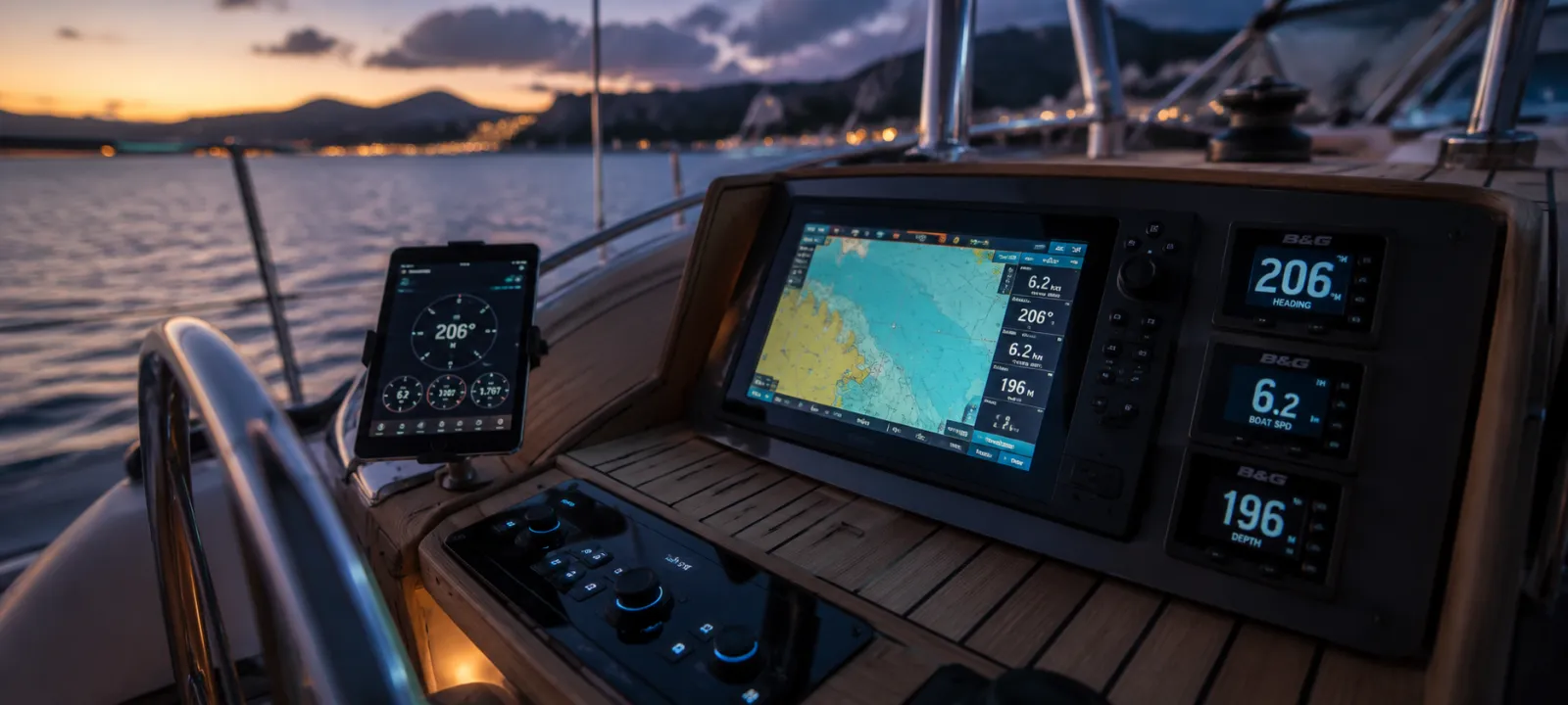
Your boat's GPS has none of these problems. A dedicated marine antenna mounted high and in the open gets a clean sky view, a solid multi-constellation fix, and a steady stream of updates. If you can get that fix onto the device running your anchor alarm, the whole thing gets better.
The three ways boat position gets shared
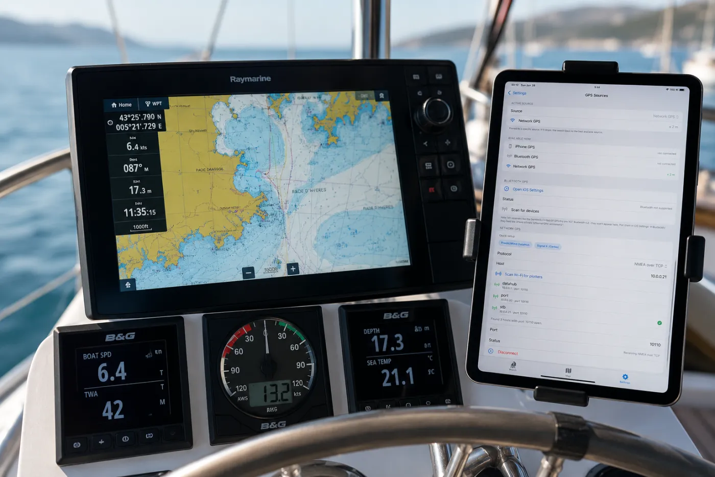
You do not need to run a wire to your phone. On most boats built or refitted in the last decade, the position is already flowing across a network you can tap into.
NMEA 0183 over WiFi or TCP
The long-standing marine data standard. Many WiFi multiplexers and instrument gateways broadcast NMEA 0183 sentences (the ones carrying position are GGA, RMC and GLL) over your boat's WiFi as a TCP or UDP stream. An app that speaks NMEA 0183 connects to that stream by IP address and port and reads the position directly.
NMEA 2000
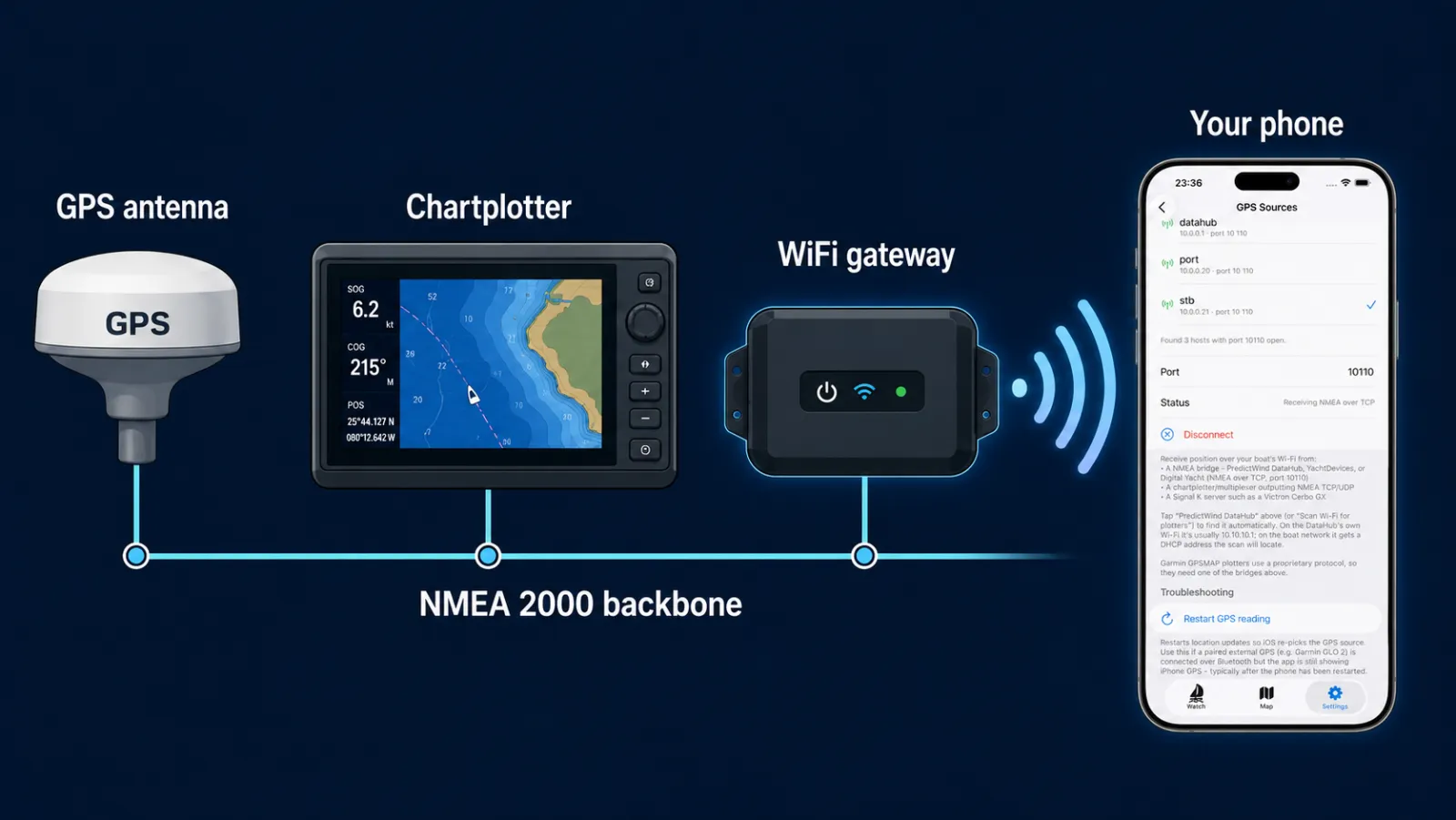
The modern backbone on newer boats. NMEA 2000 is a single network cable that ties the plotter, GPS, wind, depth and engine together. It is usually bridged onto WiFi by a gateway (for example an Actisense, Yacht Devices or Digital Yacht unit), which then presents the data as NMEA 0183 or Signal K that an app can read. One of our users runs exactly this setup, an Actisense NMEA gateway feeding the boat's GPS to Anchor Alarm Pro over the network.
"Overall I think the app is extremely promising. I especially like that it already supports external Network GPS through NMEA, which is a huge advantage over many competing anchor alarm apps."
Anchor Alarm Pro user, running an Actisense NMEA gatewaySignal K
The open, modern format that a lot of boats now run on a small onboard server such as a Victron Cerbo or a Raspberry Pi. Signal K takes in NMEA and other sources and serves position as clean, structured data over WiFi. If your boat has a Signal K server, this is often the easiest and richest source to connect to.
How to connect it, step by step
- Find your source. Identify whether your boat puts out NMEA 0183 over WiFi, or runs a Signal K server. Your gateway or plotter manual will tell you the WiFi network name, IP address and port.
- Join the boat's WiFi. Connect the phone or tablet running your anchor watch to the same onboard network as the gateway.
- Point the app at the feed. In an app that supports external GPS, add the source: enter the IP and port for NMEA, or the server address for Signal K.
- Confirm the fix. Check that the app is now showing the boat's GPS as the live position, then set your anchor and arm the watch as usual.
Anchor Alarm Pro reads your boat GPS directly
Most anchor alarm apps can only use the phone's own GPS. Anchor Alarm Pro connects to phone GPS, an external Bluetooth receiver, NMEA 0183 over the network, and Signal K, all at the same time. Auto mode always uses the most accurate live source and falls back instantly if one drops, so you get both precision and real redundancy. Free to use, no account.
The quiet superpower: run two sources at once
The best reason to use your boat GPS is not just accuracy, it is redundancy. Connect both the phone GPS and the boat GPS, and your anchor watch has two independent eyes on the same position. If the boat network hiccups or the gateway reboots, the phone keeps the watch alive without a gap. If the phone throttles its GPS overnight, the marine antenna carries it. For a piece of safety gear you are trusting while you sleep, that fallback matters more than the last metre of accuracy.
Do you need this?
If you anchor in tight spots, in strong tide, or you simply want the tightest safe circle without nuisance alarms, feeding your marine GPS into the watch is a clear upgrade. If you day-anchor in open bays, your phone alone is usually fine, especially with a watch that filters GPS jitter sensibly. Either way, the point is the same: the more accurate and more redundant your position source, the more you can trust the alarm to only wake you when it truly matters.
For the wider picture on setting up and reading a watch, see our anchoring tips for a better hold, and if you are still comparing apps, we compared the most popular anchor alarm apps here.
Connection details vary by gateway, plotter and boat. Always confirm your anchor watch is reading a live, correct position before you rely on it, and treat it as one layer of safety, not a substitute for a proper watch.